Fishing and angling
Fishing and angling is possible in the Urbersdorf district. The Urbersdorf reservoir is located in the middle of the Clusius Nature Park and is fed by the Limbach.
More information for anglers and fishermen is available at the Landgasthof Kedl on +43 3322 424030 or by email: gasthof.kedl@burgenland.org.

Flying club and gliding
Im 10 km nördlich von Güssing befindlichen Flugplatz Punitz bietet sich die Gelegenheit für herrliche Rundflüge.
The "Fliegerclub Punitz" offers sightseeing flights, trial flights and training in powered flight and gliding.
Geschichte: The success story of the Punitz airfield and thus that of the USFC Punitz begins in the early sixties of the last century.
At that time a few "nutcases" had the idea and also the courage to start the preparatory work for an airfield on some wet meadow plots.
As a provisional solution, they first thought of an outlanding meadow.
For this purpose agreements were made with the landowners, so that already in autumn 1962 the first motorized aircraft was built,
could land a Job 15 in Punitz.
In August 1964 the first flight day was organised with the help of the Graz flying school.
In 1965 the founding meeting of the "Black Eagle" (Schwarzer Adler) took place, one year later, on 2.12.1966 that of the USFC Punitz.
The airfield was upgraded by the stationing of helicopters of the Austrian Armed Forces,
who conducted surveillance flights as part of the assistance mission.
Contact:
USFC Punitz
Flugplatz 129
7544 Punitz
Phone: +43 3327 2344
Fax: +43 3327 2344
Email: office@logg.at oder info@logg.at
Internet: www.logg.at

Cycling, mountain biking
In and around Güssing there is a well signposted cycle track network.
Worth mentioning are among others:
B 56 - Stremtalradweg 1. Teil - 20 km:
B 56 - Stremtalradweg 2. Teil - 2 km:
From the "Stremtalradweg" the route always heads south to Güssing, which boasts numerous cultural and historical treasures.
The starting point is Stegersbach, along the way are the villages Bocksdorf, Rauchwart, St. Michael, Deutsch-Tschantschendorf,
Tobaj, Hasendorf, Krottendorf, until you finally arrive in the district capital Güssing.
B 60 Burg Güssing Radweg - 26 km: The B 60 - Burg Güssing Radweg - leads from Burg Güssing to Sulz in Burgenland and connects to the B 62 Apfelradweg.
The latter is named after the municipality of Kukmirn, which is known throughout Austria for its apple varieties.
Along the Apple Cycle Path lies the Auwiesen-Zickenbachtal, which has been declared a nature reserve due to its rich bird life.
The stations of the Burg Güssing cycle path are Güssing, Rosenberg, Sulz, Kroatisch Tschantschendorf, Hasendorf and Ludwigshof (district of Güssing).
The cycle path is partly very hilly.
B 61 - Wildparkradweg - 60 km: The "Wildparkradweg" leads through the enchanting landscapes of the nature park in the wine idyll.
The stations of the Wildparkradweg are Güssing, Ludwigshof (district of Güssing), Punitz, Edlitz, Kulm,
Gaas, Maria Weinberg, Strem, Hagensdorf, Luising, Deutsch-Bieling, Heiligenbrunn, Sumetendorf, Glasing and St. Nikolaus (districts of Güssing)
-> own website: www.st-nikolaus.com. The area around Punitz is hilly, the rest is flat. The Wildpark bike path is almost continuously asphalted.

Riding
Get to know Güssing and its surroundings on horseback -
In Güssing there are several riding stables and an extensive network of bridle paths with about 500 km of marked bridle paths.
You can see historical cellar quarters and rustic "Buschenschänke".
Internet: www.burgenland-im-galopp.at

Hiking and pilgrims
The following hiking trails lead through Güssing: Clusiusweg (14,7 km), Hianznpfad (12,4 km), Koglroas (12,8 km),
Öko-Energieweg (19,2 km), Ramsar Rundweg (5,08 km) and the Wasserweg, 1 stretch (6,83 km).
All hiking trails with map and route description:
Internet: www.best-of-burgenland.com/wandern.htm
Clusiusweg (14,7 km): Starting from the parking lot at the cultural centre in Güssing, you first walk along the Schulstraße until you reach the federal road B57. Then you walk the B57, past the Güssing shopping centre, out of town. At the VW dealer (Auto-Posch) turn right towards Ludwigshof. After walking through the district of Güssing, you cross the Punitzer Straße at the end of Ludwigshof and walk along a forest (Punitzer Wald), past the 1st Private Güssing Forest Nature Trail, to the Limbach Bridge. After another 200 meters, slightly uphill, you will reach the forester's lodge (ATTENTION: there are NO directions or directional arrows here). Here you have to turn sharp right. Follow this path until you see the signs for the Clusius nature trail. Following this, you will pass the Urbersdorf reservoir in the direction of Urbersdorf and continue to the Catholic daughter church of the Blessed Virgin Mary (built in 1907). Continue to the end of Urbersdorf. Here you will find a stallion press, a fountain and information boards with botanical rarities (pipe grass meadows). Crossing the B56, you continue to Hausgraben, first the Limbach, then the Strembach. Before the Strembach, turn right and follow the stream on the left bank until you reach the Glasing sewage treatment plant. Cross the bridge and follow the Strembach upstream on the right bank. Past the Sankohaz settlement to the bridge at Weidengasse. Crossing the wooden bridge, where there is a drinking fountain, you continue to the underpasses B57 and Dammstraße. Past the St. Franziskus retirement and nursing home and the information board on renewable energy, Clusiusweg leads back to the starting point at the car park Kulturzentrum.
Hianznpfad (12,4 km): Starting from the car park at the cultural centre in Güssing, follow the left bank of the Strembach downstream. Passing information boards about ÖköEnergieland (e.g. what can be done with 1 kWh), under the 1st bridge (Dammstraße), then under another bridge (Bundesstraße B57), you first enter Bahnhofstraße, then continue to Schmergelstraße or Weidengasse (alternative route, as marked) towards Stremtalstraße (B56). Along Stremtalstraße, you cross the B56 at the beginning of Apfelallee towards Urbersdorf. Passing the crossroads at the Feldmeierhof farm, passing the moor oak (turn-off to the Urbersdorf reservoir), you reach the beginning of Urbersdorf. After approx. 300 metres, at a crossroads, you will find the listed Catholic daughter church of the Blessed Virgin Mary (built in 1907). From here you pass the country inn Kedl to the crossing with the B56. At the crossing there is an old wine press (stallion press), a fountain and information boards with botanical rarities (pipe grass meadows). Crossing the B56, you continue to Hausgraben, first crossing the Limbach, then the Strembach, to the Glasinger Landesstraße (L400). On the right hand side it continues towards Glasing, passing the cemetery and fire station. At this point there are 2 possibilities. On the one hand, follow the markings up the hill, or as a more interesting route towards the local church (built in 1925/26), as far as Gasthof Silbener Hirsch. Here you will find, somewhat hidden, an "old" sign "Hianznpfod". At this crossroads, turn left uphill. At the small crossing with the information board on the theme "Paradise Route South Burgenland" both routes reunite again. From here the route continues in the direction of the St. Nikolaus district. Passing the church St. Nikolaus, the house where Josef Reichl was born, the statue of the Virgin Mary, you cross Grazer Straße (B57) at the level of the elementary school. Past the school you take the Batthyany Street towards the castle. Passing the cemetery of Güssing, the Jakobikirche (church of St. James), the road goes downhill again towards P. Gratian Leser Straße. Further on to Grabenstraße and Schulstraße. In Schulstraße near the bridge over the Strembach there is a statue of Nepomuk. After the bridge you are back at the starting point at the cultural centre (12.4 km).
Koglroas (12,8 km): Starting from the car park at the cultural centre in Güssing, you first walk up the Strembach to the bridge over the Strembach and then towards Hasendorf. After approx. 200 meters on the connecting road from Güssing (Stremtal) to Hasendorf you turn sharp left into the forest (no signposting!) and then after approx. 500 meters you reach the Hasendorfer Landesstraße (L412). Follow this road for about 100 meters in the direction of Hasendorf and then turn left up the hill (forest road). The marking at this point is the last signpost for a long time. Follow the forest (Natzwald) for a few kilometres until you reach the connecting road Sulz - Kr. Tschantschendorf, also recognisable by the marking "Vitaweg 2". Turn right at this point and walk to the border triangle (Sulz, Kr. Tschantschendorf, Tobaj, altitude 327 meters, built in 2008). Here you turn half right to the "Fabian Houses", crossing the valley (brook of Hasendorf), until you reach the B60 (Tobaj-Sauerberg). At this point you turn right again and walk along the road, past the Tobajer Kogel (the extinct volcano is the highest elevation in Tobaj) to the Güssinger Landesstraße (B57). Cross the road, pass the former, listed elementary school and walk towards the church (Catholic parish church St. Florian). From there you walk towards Pußtawald (Güssing), first crossing the Rinngraben (also Rinngrabenbach), a tributary of the Strembach, another brook (which marks the boundary of the municipality Tobaj - Güssing) to the connecting road B57 - Ludwigshof. At the plant AE111 turn right and walk towards B57 (Wiener Straße). Cross the road, walk about 200 meters out of town and turn left at the Guttmann DIY store towards Hasendorf. Continue until you reach the Strembrücke, turn left at this bridge to get to the starting point at the car park near the Kulturzentrum.
Öko-Energieweg (19,2 km): Starting from the car park at the cultural centre, you first walk up the Strem river towards Tobaj, and turn right at the concrete bridge (Stremtal) until you reach the B57 main road (Wiener Straße). At the Guttmann company, take the B57 out of town until you reach the Energie Burgenland company, cross the B57 here, and walk along the parallel road of the Wiener Straße past the Marsch and Arbö painting companies until you reach the path immediately after the Guttomat company. Follow this path in the direction of Pusstawald. Before that, turn left at Europastraße. Then walk around the Technology Centre until you come to the Pusta Forest again. Immediately after the Pusta Forest, turn left into the field path (no signposting), from here you walk towards the Ludwigshof district. After passing through the district of Güssing you cross the Punitzer Straße at the end of Ludwigshof and walk along a forest, past the 1st Private Güssing Forest Trail, until you reach the Limbach Bridge. After another 200 meters, slightly uphill, you will reach the forester's lodge (ATTENTION: there are NO directions here). Here you have to turn sharp right. Follow this path until you see the signs for the Clusius nature trail. Following this, you will pass the Urbersdorf reservoir in the direction of Urbersdorf and continue on to the Catholic daughter church of the Blessed Virgin Mary (built in 1907). Continue to the end of Urbersdorf. Here you will find a stallion press, a fountain and information boards with botanical rarities (pipe grass meadows). Crossing the B56, you continue to Hausgraben, first the Limbach, then the Strembach (here the Clusiusweg would turn right). However, turn left and walk down the Strem river on the left until you reach a concrete bridge. Cross the bridge and walk for about 300-400 metres until you reach the beginning of Sumetendorf. Here you turn right and walk again towards Glasing (Glasinger Landesstraße L400). At Hausgraben (road to Urbersdorf) turn right and walk back to the bridge over the Strem, cross it and then turn left upstream and follow the stream on the left bank (direction of flow!) to the Glasing sewage treatment plant. Cross the bridge and follow the Strembach upstream on the right bank. Past the Sankohaz settlement to the bridge at Weidengasse. Crossing the wooden bridge, where there is a drinking fountain, you continue to the underpasses B57 and Dammstraße. Past the St. Franziskus retirement and nursing home and the information board on renewable energy, the eco-energy trail leads back to the starting point at the car park Cultural Centre.
Ramsar Rundweg (5,08 km): The pond circular hiking trail built by the tourist office of the city of Güssing was opened on 15 May 2015
and has a length of about 5 kilometers.
The Güssinger ponds are Ramsar area since 2013.
The Güssinger ponds belong to the largest fish pond facilities in Austria and the management is very nature-compatible.
In the Ramsar area there are more than 300 plant species.
Particularly worth mentioning are water nut, yellow day lily, Turkish lily and swan flower.
At the Güssinger ponds 244 bird species have been recorded so far.
Wasserweg (1 stretch 6,83 km): The waterway leads from the Aktivpark, along the Strembach, Zickenbach and Sulzbach to Sulz. Starting point is the parking lot between the activity park and the cultural center Güssing (Schulstraße). From here the trail first follows the Strembach for about 200 meters to the confluence of the Zickenbach and Strembach, then crosses the wooden bridge and follows the Zickenbach in the direction of Badstraße. Follow Badstraße out of town until you reach the turn-off on the left hand side to Rosenberg. Here you cross the Zickenbach and the new Ramsar-Rundwanderweg and after about 300 meters you have to turn right. On the way and at this junction you will also find some information boards about different flowers (e.g. yellow daylily). After approx. 400 meters you reach the flood retention basin (storage volume of approx. 500,000 cubic meters), which was completed at the end of 2012. The dam height is up to 6.5 meters and should make Güssing largely flood-free. Passing the old and new sluice system (separation of Zickenbach and inflow for the ponds in Güssing), the route continues along the Zickenbach to Steingraben-Trift. When you arrive in the village, turn right into the state road L413, cross the bridge over the Zickenbach and turn left immediately. Here you will find a drinking water supply and a rest area. Approx. 1 km further on you come to the confluence of the Zickenbach and Sulzbach rivers. Just after this you will see the company Güssinger Beverages & Mineralwater GmbH (Güssinger Mineralwasser) on the left and the dilapidated former slaughterhouse Zechmeister on the right. From here, crossing the state road L118 in the direction of Sulz, you reach the local church. On the forecourt there is a monument to the Olympic champion in the parallel slalom 2014 in Sochi Julia Dujmovits and an entrance to Sulz Castle (Kastell Sulz).
Pilgrims around Güssing: In and around Güssing the specially signposted pilgrim hiking trails offer a special hiking experience.
Internet: www.pilgerinfo.at
Coat of arms
 "In golden shield, a blue, golden-jointed wall rises from a blue, golden-jointed wall, a blue, golden-jointed tower with a golden ogival gate opening, crowned with four round battlements, each of which is accompanied by two black stars".
The right to use the coat of arms was granted to the large municipality and future municipality of Güssing by decision of the Burgenland provincial government on April 11, 1973.
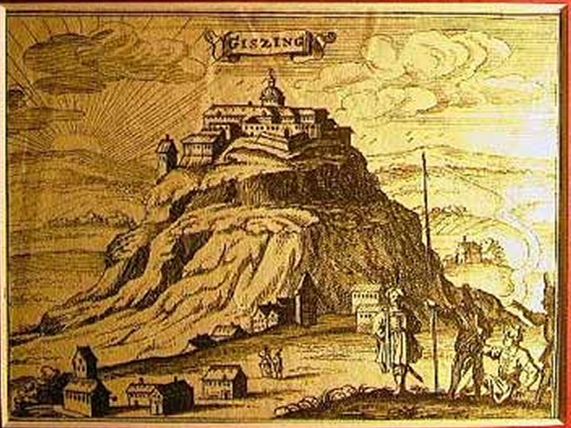
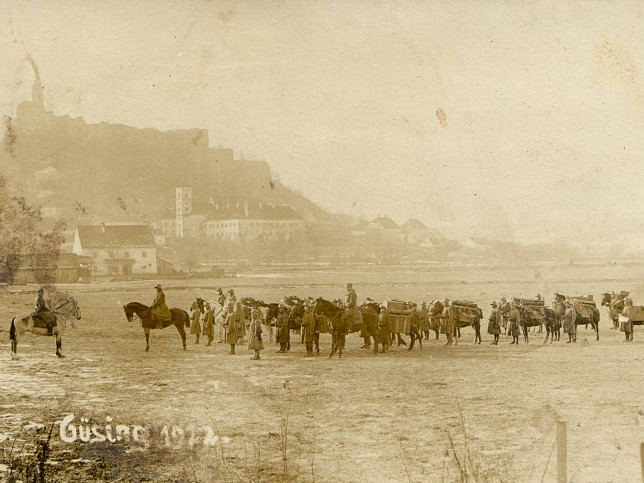
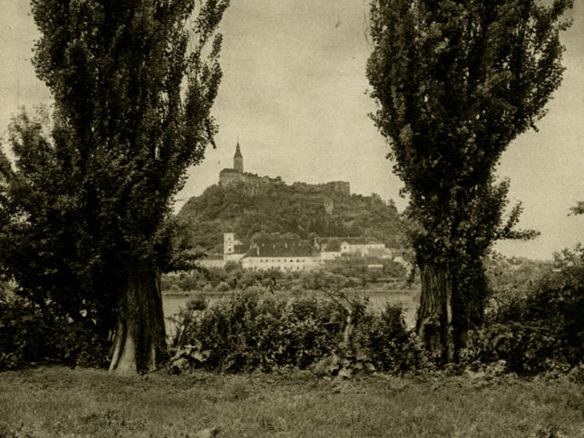
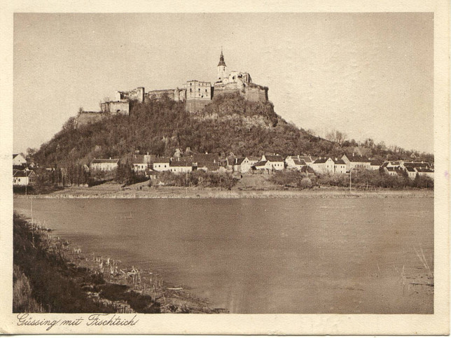
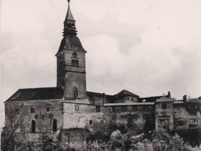
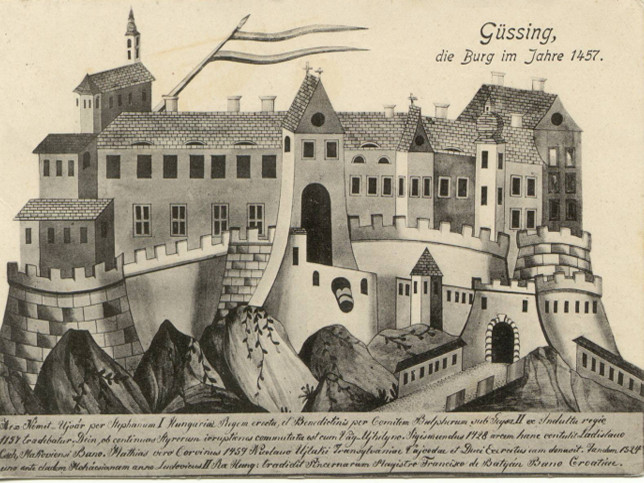
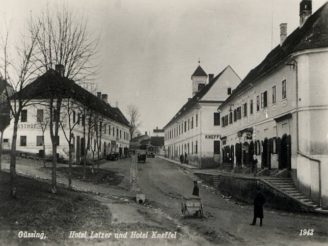
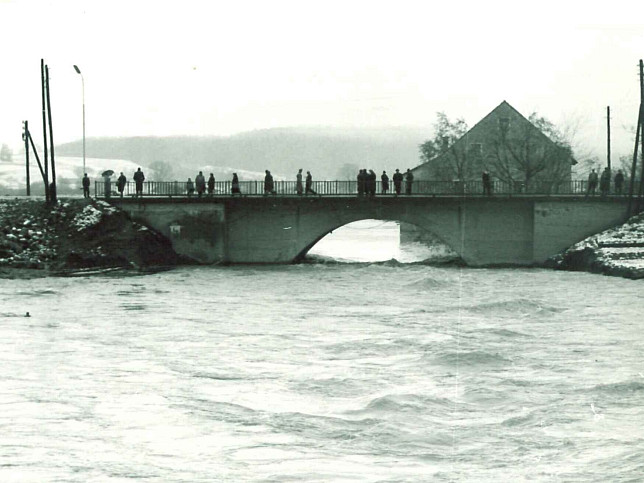
Some historical views around Güssing.
You can also visit us at Best of Burgenland
Numerous sights like the castle ruins, the Jakobikirche, the Franciscan monastery etc. testify today to the cultural and historical importance of the town of Güssing. But also today Güssing is a culturally vivid place: the Güssinger Kultur Sommer, the cultural centre, the Burgspiele, the musical Güssing are only a few examples for its manifold cultural offers.
Disclaimer
Contact
Günter Nikles
Josef Reichl-Str. 17a/7
7540 Güssing, Austria
Email:
office@nikles.net
Website:
www.nikles.net
(c) 2026 www.nikles.net


